Property Record
Highway 9P W, Lancaster, SC 29720

NEARBY LISTINGS FOR SALE OR LEASE
-
-
View all Lancaster listings for sale on LoopNet.com
Property Detail
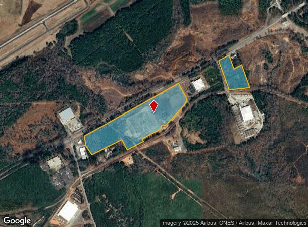
Highway 9P W
Charlotte-Concord-Gastonia, NC-SC
VACANT INDUSTRIAL SITE
0066-00-040.00
Lancaster
Governmentalpublicusegeneral
South Carolina
X
a-b
45023C0300C
60.80 AC
0
Lancaster County
2024
Charlotte
011002
DEMOGRAPHICS near Highway 9P W
1 Mile
3 Mile
5 Mile
2024 Total Population
429
8,398
25,042
2029 Population
517
10,089
29,960
Pop Growth 2024-2029
+ 20.51%
+ 20.14%
+ 19.64%
Average Age
41
40
40
2024 Total Households
176
3,418
10,199
HH Growth 2024-2029
+ 20.45%
+ 20.13%
+ 19.69%
Median Household Inc
$54,705
$50,050
$47,387
Avg Household Size
2.40
2.40
2.40
2024 Avg HH Vehicles
2.00
2.00
2.00
Median Home Value
$211,765
$172,573
$164,069
Median Year Built
1985
1974
1977
Nearby Places
Map Layers
Map Styles
 Street
 Aerial
- Restaurants
- Banks
- Shops
- Fitness
- Groceries
SALE & LEASE HISTORY
LISTING DATE
SALE/LEASE

Sep 24, 2016
For Sale
Sep 06, 2018
For Sale
Nearby Properties
Address
Land Use
TOTAL SIZE
Lot Size
Zoning
Address
Land Use
TOTAL SIZE
Lot Size
Zoning
45,440 SF
22 AC
INS
Address
Land Use
TOTAL SIZE
Lot Size
Zoning
3,249 SF
300.75 AC
INS
Address
Land Use
TOTAL SIZE
Lot Size
Zoning
71.28 AC
CITY
Address
Land Use
TOTAL SIZE
Lot Size
Zoning
228.68 AC
OSP
Address
Land Use
TOTAL SIZE
Lot Size
Zoning
20,188 SF
4.74 AC
INS
Address
Land Use
TOTAL SIZE
Lot Size
Zoning
10,774 SF
2 AC
CITY
Address
Land Use
TOTAL SIZE
Lot Size
Zoning
50,800 SF
2.90 AC
CITY
Address
Land Use
TOTAL SIZE
Lot Size
Zoning
87.44 AC
INS
Address
Land Use
TOTAL SIZE
Lot Size
Zoning
43,356 SF
5.58 AC
LI
Address
Land Use
TOTAL SIZE
Lot Size
Zoning
22,703 SF
3 AC
CITY
Address
Land Use
TOTAL SIZE
Lot Size
Zoning
2,384 SF
2.49 AC
PB
Address
Land Use
TOTAL SIZE
Lot Size
Zoning
4,396 SF
0.98 AC
NB
Address
Land Use
TOTAL SIZE
Lot Size
Zoning
33,745 SF
5.59 AC
LI
Address
Land Use
TOTAL SIZE
Lot Size
Zoning
5,910 SF
0.21 AC
CITY
Address
Land Use
TOTAL SIZE
Lot Size
Zoning
6,750 SF
4.08 AC
INS
Address
Land Use
TOTAL SIZE
Lot Size
Zoning
7,764 SF
11.63 AC
MDR
Address
Land Use
TOTAL SIZE
Lot Size
Zoning
3,713 SF
2.10 AC
CITY
Address
Land Use
TOTAL SIZE
Lot Size
Zoning
3,534 SF
1.54 AC
INS
Address
Land Use
TOTAL SIZE
Lot Size
Zoning
5,294 SF
1.21 AC
PB
Address
Land Use
TOTAL SIZE
Lot Size
Zoning
105,057 SF
13.54 AC
CITY
Address
Land Use
TOTAL SIZE
Lot Size
Zoning
3,172 SF
1.10 AC
CITY
Address
Land Use
TOTAL SIZE
Lot Size
Zoning
4,705 SF
5.12 AC
CITY
Address
Land Use
TOTAL SIZE
Lot Size
Zoning
8,272 SF
3.85 AC
CITY
Address
Land Use
TOTAL SIZE
Lot Size
Zoning
11,191 SF
2.35 AC
CITY
Address
Land Use
TOTAL SIZE
Lot Size
Zoning
520 SF
21.42 AC
INS
Address
Land Use
TOTAL SIZE
Lot Size
Zoning
4,779 SF
5.11 AC
INS
Address
Land Use
TOTAL SIZE
Lot Size
Zoning
77,662 SF
22.60 AC
LI
Address
Land Use
TOTAL SIZE
Lot Size
Zoning
6,592 SF
2.35 AC
INS
Address
Land Use
TOTAL SIZE
Lot Size
Zoning
4,550 SF
1.04 AC
GB
The World's #1 Commercial Real Estate Marketplace
Connect with us
© 2026 CoStar Group
The information above has been obtained from sources believed reliable. While we do not doubt its accuracy we have not verified it and make no guarantee, warranty or representation about it. It is your responsibility to independently confirm its accuracy and completeness. Any projections, opinions, assumptions, or estimates used are for example only and do not represent the current or future performance of the property. The value of this transaction to you depends on tax and other factors which should be evaluated by your tax, financial, and legal advisors. You and your advisors should conduct a careful, independent investigation of the property to determine to your satisfaction the suitability of the property for your needs.